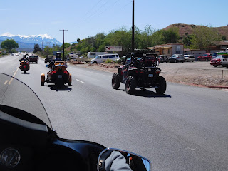
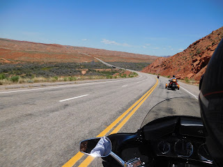
I had to get a picture of this. Something we do not see in the Cincy area, 3 trailers.
As we head into Utah, it is starting to look a little flat and the wind picked up. Not as bad as Kansas but 75 MPH and 20 mile an hour wind right at you.... makes it tough.
As we crossed the state line I check out the speed limit. 80 MPH, HOLY COW!!! Seriously.
(but we do not go that fast Mom)
Next we hit about 16 miles of one lane road. Seemed like we would never get thru it. Even in the construction zone it said, construction 70 MPH. Really!!
Neat sign at the end:
Neat sign at the end:
End Construction
Thank you
This is something you will not see too often. A full train of about 80 cars. Have to look pretty hard.
We the get to a little town called Moab. The ATVs were all over the place.
Saw a few camp ground. Larry made comment: "They have all this land around them and yet the camping is a small area. They were packed in like sardines."
Yesterday and again today we see lots of rock formations. You may think I am crazy but the pictures do not come close to doing this part of the country justice. I will probably bore you with all the scenery pics but until the Run starts this give me a chance to show you what we have in the great country.
Check out the fence posts in this one. Most of the fencing along the highway is to keep animals off the road. They normally have metal posts. There was a very long section today that I notice had just what looked like tree branches.
I kept looking at this set of mountains. I was there in person and it still seemed to be painted on the sky. What do you think? Yes there is a small wind farm there too.
Sorry this is blurry but wanted to show you how big they are. Check out the people in the middle.
These next few show how vast this country is. Well...sort of. The pictures do not do it justice.
Head now to Mexico Hat then into Monument Valley.
Looks like someone painted this.
This looks like an afghan someone quilted. I know I have one my aunt made me.
This rock is called the Mexico hat.
A little google info on Monument Valley:
Monument Valley is a region of the Colorado Plateau characterized by a cluster of vast sandstone buttes (an isolated hill with steep, often vertical sides and a small, relatively flat top), the largest reaching 1,000 ft (300 m) above the valley floor. It is located on the Arizona-Utah border near the Four Corners area (where Colorado, Utah, Arizona and N. Mexico meet). The valley lies within the range of the Navajo Nation Reservation Highway 163.
Crossing San Jose River and entering into the Monument Valley
Looks like angle wings to me.
We saw several Navajo stands like this. Every single one had American flags.
Lunch was at Goulding's. I did not think we were going to make it.
As we head down this road, from the left, a few dogs were chasing about 10-12 cows. They were heading straight for us. Ken was far enough up that he sped up to miss them. Jenny then Larry and I, were right in their path. All at once a red truck came from the other direction between us and the cows. This made the cows made a quick 90 degree turn and missed us. Not sure how they missed the truck. Needless to say all of our hearts were about out of our chest on that one. Must have been the angel wings we just past that helped us out. Also all those praying for safe travel for all the RFTW riders that got us thru. THANKS.
This is Ken and Jenny heading to restuarant. Beautiful setting.
Ken and Jenny were telling us that years ago John Wayne make several movies in this area.
Larry decided to talk to Mr. Wayne.
Looks just like a glove.
Looks just like an owl.
Heading out of Monument Valley. Still great view!!!
There were signs posted to watch out for horses. We saw several.
You will have to double click this one to see it better. It was a guy moving 2 horses. I have no clue to where because there was nothing around for miles.
Now we head to Flagstaff then to our stop for the night in Williams. This is also the town we will stop for our first night on RFTW. See all the pine trees. We could smell the pines trees as we were riding along. You know that smell.
Ending the day with a neat picture of the clouds as we came into Williams.
And my favor pic of the day.
Route:I 70 to SR191, to SR163, to SR160, to SR89, to I 40
Temps: started about 50, high of 94, 72 when we got into Williams.
494 miles for the day. Elevation about 7200 for the high.


No comments:
Post a Comment